Driving Highway 5 South in Baja from San Felipe, and the Lake that Wasn’t There
 Most people think that the most important Spanish phrase you could learn is “Dónde está el baño?” (Where’s the bathroom?), “Cuánto cuesta este?” (How much is this?) or even, “Camarero, dos margaritas más, por favor (Bartender, two more margaritas, please). While all these are very good to know in appropriate circumstances, my view is that the most important phrase to learn while driving south from San Felipe through Baja on Highway 5 (pretty much the only road you can take south from San Felipe) is “Tanque lleno” which, loosely translated, means “Fill ‘er up.”
 The reason is that, in this area, there are long stretches with few gas stations, so we made sure our “tanque” was very much “lleno” before we left.
It’s not that we weren’t warned about taking Highway 5 south. Many people warned us, including the owner of the Sandollar Beach Resort in San Felipe, where we stayed and which we highly recommend. But could we discount this man’s warning? Was he some type of dilettante who scared easily? Not likely, given that he had made his living crop dusting in Northern California and currently rode dirt bikes for a hobby. 99%+ of the people driving through Baja take Highway 1, but we took 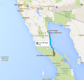 Highway 5 because it took less time overall and we wanted to see things off the beaten (or even paved) path.
 Highway 5 because it took less time overall and we wanted to see things off the beaten (or even paved) path.
 We weren’t disappointed.
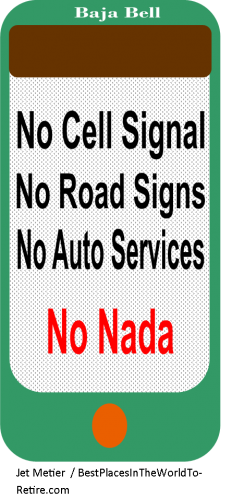
Upon leaving San Felipe and heading south on Highway 5, you pretty much immediately lose whatever cell signal you may have had. At this point, you don’t care. The Sea of Cortez is on your left, as you come upon a series of beautiful, secluded and seemingly untouched beaches and bays with white sand and blue ocean, almost always completely empty of people, many times with islands dotting the horizon and sometimes with islands close enough for an easy kayaking trip from the shore. You just can’t see and experience these gems if you don’t drive it or sail to it, and it’s hard to keep your eyes on the road as you are treated to one spectacular and inviting beach and bay after another. This stretch of the road is not maintained flawlessly, but it is paved well enough, given the small amount of traffic it carries.
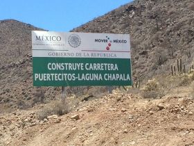 After being treated to these delights, Highway 5 and the coast diverge, as the highway heads almost directly south while the coast turns slightly eastward. A little while later, with very little fanfare (and just a little sign with an arrow on it), you’re directed onto a bone jarring, teeth filling-loosening, rutted, rock and dirt road that continues this way for many miles. Along the way, there are cut-offs that either 1) you should take; or, 2) are meant for construction equipment and may terminate in a dead end or in a sharp decent down a ravine that, if you make a wrong move, they may not find you for months. Given that there are generally no signs to let you know which road to take and it is so deserted that there is no one to follow, you make the call. If you’re wrong, don’t worry; you won’t be subjected to ridicule from other drivers, because there are virtually no other drivers there to honk and point. You just find a place wide enough to turn around. I’m not certain if I remember vultures circling above, but I may have.
 On one such fork in the road, my wife and I made a full stop right in the middle before one such fork and were debating which one of two roads to take. We essentially flipped a coin and then started on the one to the right. As out of a Twilight Zone episode, two Mexican men appeared over a hill, walking towards us. They were well dressed, in polo shirts and long pants with crisp creases. Both looked completely fresh, in stark contrast to their dusty surroundings. They called for us to come over, so we bumpily approached at our normal speed in this area, which was about 10 miles per hour.
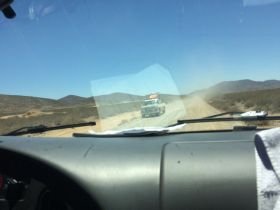 The men said their car had blown a tire some ways back (which is really not hard to imagine), and they were walking for help. (Yes, it’s that deserted.) We asked if we could give them water or food, which they declined, but they asked if we could give it to the first man’s wife and the second man’s father, who were back at the car. We all agreed, so we bid farewell, and they passed behind us, disappearing in my side view mirror, as we jarred forward in the opposite direction. About 5 minutes later, we came upon the broken down car and delivered the breakfast bars and water, which, although they didn’t speak English, it was clear that the recipients were very grateful to have.
 Depending on your religious beliefs or lack thereof, you will either pray or hope real hard in this area that you don’t break down like the people we passed. It’s not that no one will help you. Of course they will; it’s the nature of the people in this area to help. It’s just that breaking down would be really inconvenient.
Irrespective of language or culture, many things are the same, like how people respond when driving about 20 miles or so on a deeply rutted, rocky road. For example, about half an hour later, we came across another car going in the opposite direction, at about the same speed as us. Given our less than race car velocity, that we hadn’t seen another human for 10 minutes, and the fact the driver had rolled down his window and was waving at us to stop, we stopped. In broken English, the man driving (who was clearly the husband and father) asked, “How much further to the end?”
It’s at times like these when you have a choice to make: tell the truth, or something that will encourage people and make them feel better. We chose the truth. “About an hour,” we said.
The groans from the unseen children in the back seat and the wife in the front were unmistakable, in any language. The man driving looked crestfallen, as would any father and husband who had promised his family a nice drive in the country only to subject them to miles and miles of bumping.
“But it’s worth it!” I said, trying to make the best of it.
Then I asked, “How much further until we reach the end?”
The husband / father said, “About half an hour.”
Immediately, the chorus of wife and children let it be known, in any language, that it was their opinion that it was much further than half an hour. The husband / father grimaced, nodded at me (one husband / father to another), waved meekly, rolled up his window, and soldiered on.
.png) One of the advantages of going so slowly in this area is that we were able to grasp the enormity and engineering complexity of the construction project we were seeing in the making. They had already built immense concrete structures to move water; there were gigantic drains, huge trucks, etc.
One of the advantages of going so slowly in this area is that we were able to grasp the enormity and engineering complexity of the construction project we were seeing in the making. They had already built immense concrete structures to move water; there were gigantic drains, huge trucks, etc. On the map, we knew that, to mark the end of our unimproved ordeal, almost exactly in the middle of Baja from side to side, we would see a pretty good-sized lake on our left, marked as “Lake Chapala”, which would be where Highway 5 terminated into Highway 1 in a very distinct “T”. We would simply make a left onto Highway 1 (the highway taken by those 99%+ of the people who drive south through Baja) and merrily be on our hopefully very smooth way.
There is no lake. There isn’t even a swamp. It’s bone dry in every direction. There was, however, a distinct “T”. It was so unremarkable (and so unsigned) that, even though it was unmistakably a T in the road, I needed to make sure we were in the right place. The only sign of civilization I could find to in which to ask was a tire workshop just off the road facing the T on Highway 1, with three dogs guarding the place and two men working in the back, all of whom looked surprised when I approached.
.jpg) I made friends with the barking dogs and asked the men if we were in the right place. One spoke very good English and told me that we were.
I made friends with the barking dogs and asked the men if we were in the right place. One spoke very good English and told me that we were. I pointed to the map I had brought out of the van for verification. “Where is the lake?” I asked, as if, if it were on the map, it just had to be there.
The man looked at the map, showed it to his friend, and they both laughed a knowing laugh. “It dried up decades ago.”
When I remarked that it might have been a good idea to remove the lake from the map, of course, he agreed, and told me the story of a woman who had driven for hours just to paddle on the lake that was not there.
I then offered that it would be a good idea to have a sign at the T.
He agreed again.
So, with nothing to mark the successful completion of our ordeal and safe passage other than three dogs, two men and an incorrect map, onward we drove on Highway 1 south, on a very good road, towards San Ignacio.
Next stop: a yurt and a lake in the mountains and beaches so awesome they defy description.*
*But we have pictures.
See links to all road trip stories below. You are currently reading the one highlighted with the yellow background.
To see hundreds of questions answered by expats already living in Mexico, click here.
To see hundreds of questions answered by expats already living in Mexico, Panama, Belize, Nicaragua and Portugal, go here and navigate to the place you're most interested in.
Sign up for the Best Places in the World to Retire newsletter. To see additional additional pictures and videos not in the stories, follow us on Facebook. To see more videos of the trip, see our YouTube channel.
Want online, interactive help finding the best place abroad for you? Try the Location Advisor.
Download the free eBook of all the stories below, "Our Year on the Road & Living in Mexico-- Adventures, Challenges, Triumphs, Lessons Learned"
Links to Mexico Road Trip stories:
Editor’s note: you may freely reprint the article above, provided you put this at the beginning or end:
Content provided by Best Places in the World to Retire, which provides credible answers to questions about moving abroad, expat stories, and a location advisor to help you find the perfect place for you.
Content provided by Best Places in the World to Retire, which provides credible answers to questions about moving abroad, expat stories, and a location advisor to help you find the perfect place for you.


.png)